


Goodsprings Center-W. Limestone FD- Lester PO, Limestone County, Alabama
About
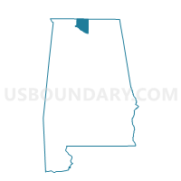
Outline

Summary
| Unique Area Identifier | 522295 |
| Name | Goodsprings Center-W. Limestone FD- Lester PO |
| County | Limestone County |
| State | Alabama |
| Area (square miles) | 35.37 |
| Land Area (square miles) | 35.04 |
| Water Area (square miles) | 0.33 |
| % of Land Area | 99.06 |
| % of Water Area | 0.94 |
| Latitude of the Internal Point | 34.95020090 |
| Longtitude of the Internal Point | -87.16110800 |
Maps


Graphs
Select a template below for downloading or customizing gragh for Goodsprings Center-W. Limestone FD- Lester PO, Limestone County, Alabama


Neighbors
Neighoring Voting District (by Name) Neighboring Voting District on the Map
- 2A Minor Hill Voting District, Giles County, TN
- Anderson Town Hall, Lauderdale County, AL
- Leggtown Store, Limestone County, AL
- Owens Community Building, Limestone County, AL
- Pleasant Grove FD, Limestone County, AL
Top 10 Neighboring County Subdivision (by Population) Neighboring County Subdivision on the Map
- Athens CCD, Limestone County, AL (69,761)
- Rogersville CCD, Lauderdale County, AL (8,630)
- District 2, Giles County, TN (4,142)
- Salem CCD, Limestone County, AL (3,583)
Top 10 Neighboring Place (by Population) Neighboring Place on the Map
Top 10 Neighboring Unified School District (by Population) Neighboring Unified School District on the Map
- Limestone County School District, AL (57,348)
- Lauderdale County School District, AL (53,390)
- Giles County School District, TN (29,485)
Top 10 Neighboring State Legislative District Lower Chamber (by Population) Neighboring State Legislative District Lower Chamber on the Map
- State House District 65, TN (60,102)
- State House District 5, AL (48,495)
- State House District 2, AL (45,462)
Top 10 Neighboring State Legislative District Upper Chamber (by Population) Neighboring State Legislative District Upper Chamber on the Map
- State Senate District 2, AL (179,058)
- State Senate District 25, TN (176,409)
- State Senate District 1, AL (135,057)
Top 10 Neighboring 111th Congressional District (by Population) Neighboring 111th Congressional District on the Map
Top 10 Neighboring Census Tract (by Population) Neighboring Census Tract on the Map
- Census Tract 204.01, Limestone County, AL (5,961)
- Census Tract 118.01, Lauderdale County, AL (4,922)
- Census Tract 203, Limestone County, AL (3,583)
- Census Tract 9206, Giles County, TN (2,814)